2006
SE1320 : Hay field and Lower Edge Quarry, Rastrick
taken 18 years ago, near to Rastrick, Calderdale, England
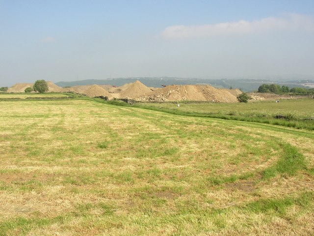
Hay field and Lower Edge Quarry, Rastrick
I was following a dog-walker's path up the side of a hay field. At the top of the hill, the hay had been cut in the next field. Lower Edge Quarry is in the distance, although the part to the left was called New Delight Quarries. A few people walking dogs can be seen, although there are no public footpaths up here.
 Map © Crown Copyright")
TIP: Click the map for more Large scale mapping
- Grid Square
- SE1320, 230 images (more nearby 🔍)
- Photographer
- Humphrey Bolton (more nearby)
- Date Taken
- Saturday, 10 June, 2006 (more nearby)
- Submitted
- Wednesday, 21 June, 2006
- Subject Location
-
OSGB36:
 SE 130 209 [100m precision]
WGS84: 53:41.0639N 1:48.2787W - View Direction
- Northwest (about 315 degrees)