2010
NM7129 : Maol an t-Searraich, Mull
taken 14 years ago, near to Croggan, Isle of Mull, Argyll And Bute, Scotland
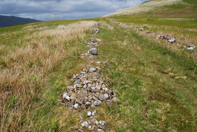
Maol an t-Searraich, Mull
The twin stone walls that mark out the track may be related to the ruined settlement about 200m S.
 Map © Crown Copyright")
TIP: Click the map for more Large scale mapping
- Grid Square
- NM7129, 7 images (more nearby 🔍)
- Photographer
- David G Campbell (more nearby)
- Date Taken
- Wednesday, 2 June, 2010 (more nearby)
- Submitted
- Monday, 7 June, 2010
- Subject Location
-
OSGB36:
 NM 7144 2931 [10m precision]
WGS84: 56:24.0345N 5:42.3356W - Camera Location
-
OSGB36: NM 71398 29161
- View Direction
- North-northeast (about 22 degrees)