2010
TL8564 : Abbots Bridge over the River Lark
taken 14 years ago, near to Bury st Edmunds, Suffolk, England
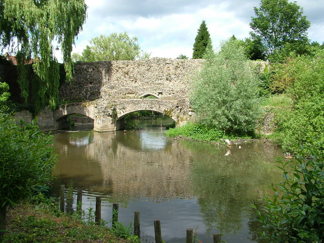
Abbots Bridge over the River Lark
The Abbey evidently felt the need for defensive walls, like a medieval town. At the point where the walls crossed the River Lark they doubled as a bridge and this survives. On the other side of the wall Eastgate Street passes over a modern bridge.
 Map © Crown Copyright")
TIP: Click the map for more Large scale mapping
- Grid Square
- TL8564, 1965 images (more nearby 🔍)
- Photographer
- John Goldsmith (more nearby)
- Date Taken
- Saturday, 12 June, 2010 (more nearby)
- Submitted
- Monday, 14 June, 2010
- Subject Location
-
OSGB36:
 TL 858 643 [100m precision]
WGS84: 52:14.7680N 0:43.2276E - Camera Location
-
OSGB36: TL 857 642
- View Direction
- North-northeast (about 22 degrees)