2006
NM9818 : Aqueduct
taken 18 years ago, near to Inverinan, Argyll And Bute, Scotland
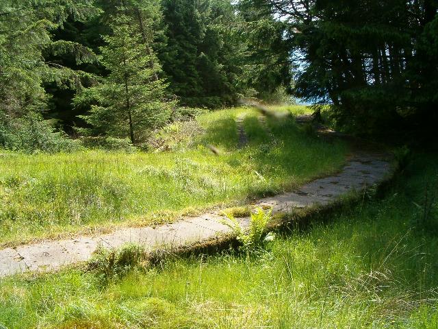
Aqueduct
The aqueduct, which is under the concrete slabs in the foreground, collects water from the Abhainn Foinain catchment and transports it to the Loch Nant hydroelectric scheme.
 Map © Crown Copyright")
TIP: Click the map for more Large scale mapping
- Grid Square
- NM9818, 4 images (more nearby 🔍)
- Photographer
- Patrick Mackie (more nearby)
- Date Taken
- Sunday, 25 June, 2006 (more nearby)
- Submitted
- Sunday, 25 June, 2006
- Subject Location
-
OSGB36:
 NM 989 189 [100m precision]
WGS84: 56:19.1814N 5:15.2088W - View Direction
- West-southwest (about 247 degrees)