2010
ST5318 : Vagg Lane
taken 14 years ago, near to Chilthorne Domer, Somerset, England
This is 1 of 2 images, with title Vagg Lane in this square
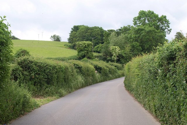
Vagg Lane
Further up ST5319 : Vagg Lane, which was part of the turnpike of 1753 between Ilchester and Yeovil Link . The lane turns right by the trees; the line of the turnpike continues ahead up the hill, following the Roman road towards Yeovil.
 Map © Crown Copyright")
TIP: Click the map for more Large scale mapping
- Grid Square
- ST5318, 10 images (more nearby 🔍)
- Photographer
- Derek Harper (more nearby)
- Date Taken
- Wednesday, 9 June, 2010 (more nearby)
- Submitted
- Tuesday, 15 June, 2010
- Subject Location
-
OSGB36:
 ST 5307 1890 [10m precision]
WGS84: 50:58.0558N 2:40.1820W - Camera Location
-
OSGB36: ST 5306 1894
- View Direction
- South-southeast (about 157 degrees)