2010
NZ6418 : The A173 road near Duck Hill
taken 14 years ago, near to Upleatham, Redcar And Cleveland, England
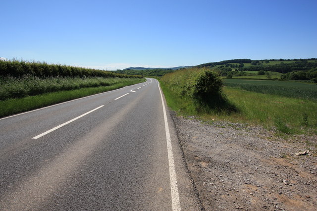
The A173 road near Duck Hill
This photograph shows a view of a section of the A173 road near Duck Hill as it passes through the grid-square. The transmitter near Park Farm can just be seen on the horizon. The picture was taken looking in a west-south-westerly direction towards Tocketts Mill.
 Map © Crown Copyright")
TIP: Click the map for more Large scale mapping
- Grid Square
- NZ6418, 17 images (more nearby 🔍)
- Photographer
- Philip Barker (more nearby)
- Date Taken
- Thursday, 17 June, 2010 (more nearby)
- Submitted
- Friday, 18 June, 2010
- Subject Location
-
OSGB36:
 NZ 641 185 [100m precision]
WGS84: 54:33.4822N 1:0.5367W - Camera Location
-
OSGB36: NZ 643 185
- View Direction
- West-southwest (about 247 degrees)