2010
SM9632 : Old lane to Trecwn
taken 14 years ago, near to Trecwn, Pembrokeshire/Sir Benfro, Wales
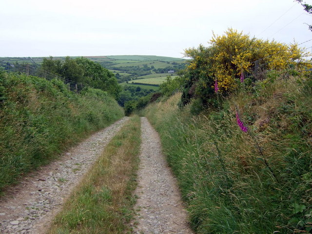
Old lane to Trecwn
A route for walkers and farm vehicles now but once it would have been a way to get to the church of St Mary's, Llanfair Nant-y-Gof, which is the grey building just visible across the valley, see SM9632 : St Mary's church, Llanfair-nant-y-gof
 Map © Crown Copyright")
TIP: Click the map for more Large scale mapping
- Grid Square
- SM9632, 25 images (more nearby 🔍)
- Photographer
- Natasha Ceridwen de Chroustchoff (more nearby)
- Date Taken
- Friday, 18 June, 2010 (more nearby)
- Submitted
- Friday, 18 June, 2010
- Subject Location
-
OSGB36:
 SM 967 329 [100m precision]
WGS84: 51:57.4514N 4:57.5604W - Camera Location
-
OSGB36: SM 967 329
- View Direction
- SOUTH (about 180 degrees)