2010
SP0684 : River Rea, Edgbaston
taken 14 years ago, near to Edgbaston, Birmingham, England
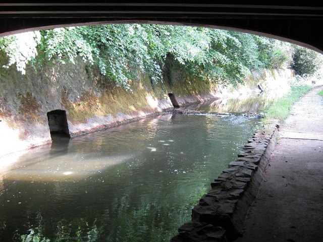
River Rea, Edgbaston
River Rea, and outlets in walls from Cannon Hill Park. Riverside walk starts from Edgbaston Road (above) and heads south alongside Park and Nature Reserve
 Map © Crown Copyright")
TIP: Click the map for more Large scale mapping
- Grid Square
- SP0684, 179 images (more nearby 🔍)
- Photographer
- Michael Westley (more nearby)
- Date Taken
- Friday, 28 May, 2010 (more nearby)
- Submitted
- Friday, 18 June, 2010
- Subject Location
-
OSGB36:
 SP 067 840 [100m precision]
WGS84: 52:27.2456N 1:54.0994W - Camera Location
-
OSGB36: SP 067 840
- View Direction
- SOUTH (about 180 degrees)