2010
SO2383 : Fields near Stone House Farm
taken 14 years ago, near to Hall of The Forest, Shropshire, England
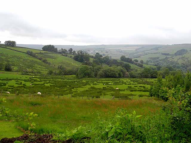
Fields near Stone House Farm
Looking across some rather poor grazing to Stone House Farm on the opposite ridge. The valley of the Folly Brook lies beyond.
 Map © Crown Copyright")
TIP: Click the map for more Large scale mapping
- Grid Square
- SO2383, 4 images (more nearby 🔍)
- Photographer
- Oliver Dixon (more nearby)
- Date Taken
- Monday, 14 June, 2010 (more nearby)
- Submitted
- Saturday, 19 June, 2010
- Subject Location
-
OSGB36:
 SO 230 839 [100m precision]
WGS84: 52:26.8948N 3:8.0367W - Camera Location
-
OSGB36: SO 232 834
- View Direction
- North-northwest (about 337 degrees)