2010
NO7590 : Fire Break
taken 14 years ago, near to Lochton, Aberdeenshire, Scotland
This is 1 of 2 images, with title Fire Break in this square
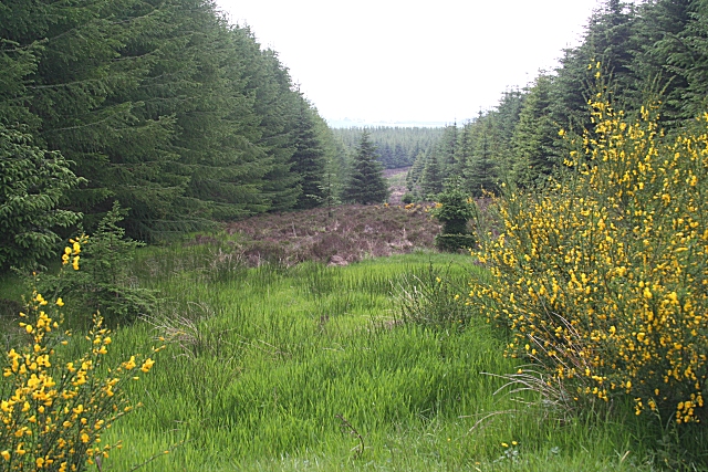
Fire Break
The fire break continues the line of a side road here which leads up to Mongour, but the bright green of the new grass suggest that it is boggy and there is no evidence of a road or path. However there is a clue to its width, if not the reason for its existence, in NO7590 : Forest Sideroad.
 Map © Crown Copyright")
TIP: Click the map for more Large scale mapping
- Grid Square
- NO7590, 15 images (more nearby 🔍)
- Photographer
- Anne Burgess (more nearby)
- Date Taken
- Thursday, 17 June, 2010 (more nearby)
- Submitted
- Saturday, 19 June, 2010
- Subject Location
-
OSGB36:
 NO 751 905 [100m precision]
WGS84: 57:0.3255N 2:24.6941W - Camera Location
-
OSGB36: NO 751 904
- View Direction
- NORTH (about 0 degrees)