2010

SK9022 : Stainby: the B676 crosses the former High Dyke Branch

taken 14 years ago, near to Stainby, Lincolnshire, England
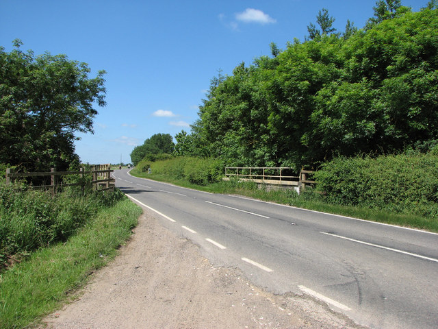
Stainby: the B676 crosses the former High Dyke Branch
The Great Northern Railway High Dyke Branch, built during the Great War to carry iron ore from the iron-rich area south of Grantham, made an end-on connexion with the Buckminster quarries railway system at Stainby, and opened in 1916. This is the last Great Northern bridge on the branch, immediately north of Stainby Station (not a station in the accepted sense, but just a siding), whose landscaped site is just to the left. There were extensive interchange sidings to the north of this bridge. Quarrying, which extended over the parishes of Stainby, Sewstern, Gunby, Buckminster, North Witham and Thistleton, ceased in the 1970s and the land has been restored to agriculture. The last quarries, at Stainby Glebe, worked till 1973, were north-east of here.

Creative Commons Licence [Some Rights Reserved]   © Copyright John Sutton and licensed for reuse under this Creative Commons Licence.
This photo is linked from: Automatic Clusters: · Bridge on the High Dyke Branch [4] ·
1:50,000 Modern Day Landranger(TM) Map © Crown Copyright
+
+
1:50,000 Modern Day Landranger(TM) Map © Crown Copyright
TIP: Click the map for more Large scale mapping
Grid Square
SK9022, 32 images   (more nearby 🔍)
Photographer
John Sutton   (more nearby)
Date Taken
Thursday, 17 June, 2010   (more nearby)
Submitted
Monday, 21 June, 2010
Subject Location
OSGB36: geotagged! SK 902 227 [100m precision]
WGS84: 52:47.6976N 0:39.7966W
Camera Location
OSGB36: geotagged! SK 903 227
View Direction
WEST (about 270 degrees)
Clickable map
+
NW N NE
W Go E
SW S SE
Image classification(about): Geograph
This page has been viewed about 106 times
You are not logged in login | register