2010
NN2522 : High, rough grassland south of Ben Lui
taken 14 years ago, near to Allt an Iaruinn [water Feature], Argyll And Bute, Great Britain
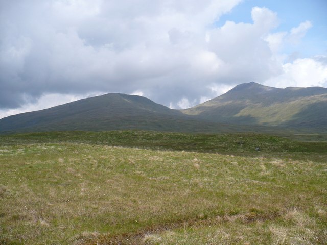
High, rough grassland south of Ben Lui
The land round here is at around 400m, but mainly flat and tussocky. Big hills surroound you in the distance. In this photo are Beinn a'Chleibh (916m) and Ben Lui (1130m).
 Map © Crown Copyright")
TIP: Click the map for more Large scale mapping
- Grid Square
- NN2522 (more nearby 🔍)
- Photographer
- Andrew Spenceley (more nearby)
- Date Taken
- Monday, 7 June, 2010 (more nearby)
- Submitted
- Tuesday, 22 June, 2010
- Subject Location
-
OSGB36:
 NN 256 228 [100m precision]
WGS84: 56:21.9218N 4:49.4781W - Camera Location
-
OSGB36: NN 254 221
- View Direction
- North-northeast (about 22 degrees)