2010
NO1783 : Stream gully with stories to tell
taken 14 years ago, 4 km E of Baddoch, Aberdeenshire, Scotland
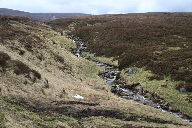
Stream gully with stories to tell
The land form was probably modified during periglacial period when the surface flowed slowly under the seasonal effect of frost melt over a permafrost layer, the stream keeping its channel clear.
Vegetation clearly shows where access to nutrients favours grasses in the wetter areas close to the burn, but heather dominates where highly acid peat has accumulated.
A small patch of snow remains, and in front of this eroded peat lies on top of vegetation from the previous month's intense snow melt.
 Map © Crown Copyright")
TIP: Click the map for more Large scale mapping
- Grid Square
- NO1783, 5 images (more nearby 🔍)
- Photographer
- Nic Bullivant (more nearby)
- Date Taken
- Saturday, 29 May, 2010 (more nearby)
- Submitted
- Tuesday, 22 June, 2010
- Subject Location
-
OSGB36:
 NO 171 833 [100m precision]
WGS84: 56:56.0452N 3:21.7543W - Camera Location
-
OSGB36: NO 172 834
- View Direction
- Southwest (about 225 degrees)