2010
SK5035 : Pedestrian way
taken 14 years ago, near to Toton, Nottinghamshire, England
This is 1 of 3 images, with title starting with Pedestrian in this square
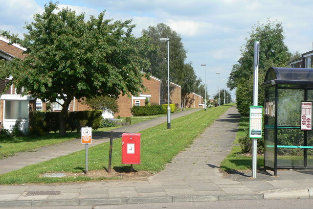
Pedestrian way
The south west corner of the Chilwell estate was developed on principles derived from the Radburn-type layout, with pedestrian and vehicle access to dwellings kept separate.
 Map © Crown Copyright")
TIP: Click the map for more Large scale mapping
- Grid Square
- SK5035, 56 images (more nearby 🔍)
- Photographer
- Alan Murray-Rust (more nearby)
- Date Taken
- Monday, 21 June, 2010 (more nearby)
- Submitted
- Wednesday, 23 June, 2010
- Subject Location
-
OSGB36:
 SK 5049 3592 [10m precision]
WGS84: 52:55.1001N 1:15.0321W - Camera Location
-
OSGB36: SK 5037 3591
- View Direction
- EAST (about 90 degrees)