2010
TQ5478 : The Dartford Flood Barrier, viewed from the steps to the Rainham Marshes Information Centre
taken 14 years ago, near to Purfleet-on-Thames, Thurrock, England
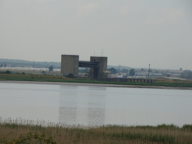
The Dartford Flood Barrier, viewed from the steps to the Rainham Marshes Information Centre
Looking southwest.
 Map © Crown Copyright")
TIP: Click the map for more Large scale mapping
- Grid Square
- TQ5478, 130 images (more nearby 🔍)
- Photographer
- Robert Lamb (more nearby)
- Date Taken
- Friday, 25 June, 2010 (more nearby)
- Submitted
- Friday, 25 June, 2010
- Subject Location
-
OSGB36:
 TQ 540 780 [100m precision]
WGS84: 51:28.8154N 0:13.0139E - Camera Location
-
OSGB36: TQ 546 788
- View Direction
- Southwest (about 225 degrees)