2010
SU4790 : Water Tower
taken 14 years ago, near to Milton Hill, Oxfordshire, England
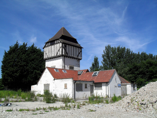
Water Tower
This water tower now stands in isolation in the north west corner of a former research centre site. All the buildings shown to the south on the map have been demolished as far as the central drive and the site is currently (June 2010) just heaps of rubble.
I guess this tower counts as a building of interest so has been spared.
I guess this tower counts as a building of interest so has been spared.
 Map © Crown Copyright")
TIP: Click the map for more Large scale mapping
- Grid Square
- SU4790, 38 images (more nearby 🔍)
- Photographer
- Des Blenkinsopp (more nearby)
- Date Taken
- Monday, 21 June, 2010 (more nearby)
- Submitted
- Saturday, 26 June, 2010
- Subject Location
-
OSGB36:
 SU 474 905 [100m precision]
WGS84: 51:36.7021N 1:19.0033W - Camera Location
-
OSGB36: SU 474 905
- View Direction
- North-northwest (about 337 degrees)