2010
NN0519 : Edge of the forest
taken 14 years ago, 4 km SSE of Annat, Argyll And Bute, Scotland
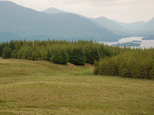
Edge of the forest
Looking back at a large ride running into Upper Sonachan forest with Loch Awe behind. I had intended to exit the forest at this point but became lost in the trees and ended up 400m to the south.
 Map © Crown Copyright")
TIP: Click the map for more Large scale mapping
- Grid Square
- NN0519, 4 images (more nearby 🔍)
- Photographer
- Patrick Mackie (more nearby)
- Date Taken
- Saturday, 26 June, 2010 (more nearby)
- Submitted
- Sunday, 27 June, 2010
- Subject Location
-
OSGB36:
 NN 055 192 [100m precision]
WGS84: 56:19.5081N 5:8.8297W - Camera Location
-
OSGB36: NN 053 190
- View Direction
- Northeast (about 45 degrees)