TQ3265 : Hospital of the Holy Trinity, Croydon
taken 14 years ago, near to Croydon, England
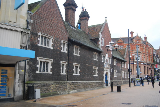
Almshouses are charitable housing provided to enable people (typically elderly people who can no longer work to earn enough to pay rent) to live in a particular community. They are often targeted at the poor of a locality, at those from certain forms of previous employment, or their widows, and are generally maintained by a charity or the trustees of a bequest.
Alms are, money or services donated to support the poor and indigent. Almshouses were established from the 10th century in Britain, to provide a place of residence for poor, old and distressed folk. The first recorded almshouse was founded in York by King Athelstan; the oldest still in existence is the Hospital of St. Cross in Winchester, dating to about 1132. In the Middle Ages, the majority of European hospitals functioned as almshouses.
An incomplete list of British Almshouses can be found at Link
Grade I listed buildings and structures are of exceptional, even international importance. There are over 6,000 in the country. Only 2.5% of listed buildings are Grade I listed.
In Scotland the classification is Category A
Index: Link
 Map © Crown Copyright")
- Grid Square
- TQ3265, 1302 images (more nearby 🔍)
- Photographer
- N Chadwick (more nearby)
- Date Taken
- Saturday, 8 May, 2010 (more nearby)
- Submitted
- Sunday, 27 June, 2010
- Subject Location
-
OSGB36:
 TQ 323 656 [100m precision]
WGS84: 51:22.4697N 0:6.0183W - Camera Location
-
OSGB36: TQ 322 656
- View Direction
- Southeast (about 135 degrees)