2010
SO2790 : Warbury
taken 14 years ago, 3 km from Churchstoke, Powys, Wales
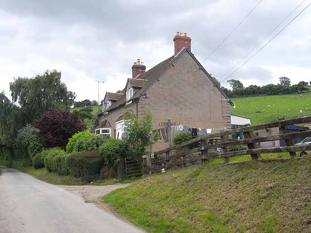
Warbury
House on the steep slope below the Kerry Ridgeway overlooking the Vale of Montgomery. The road is part of National Cycle Network route 44 (Six Castles Cycleway) between Shrewsbury and Leominster.
 Map © Crown Copyright")
TIP: Click the map for more Large scale mapping
- Grid Square
- SO2790, 9 images (more nearby 🔍)
- Photographer
- Oliver Dixon (more nearby)
- Date Taken
- Sunday, 13 June, 2010 (more nearby)
- Submitted
- Sunday, 27 June, 2010
- Subject Location
-
OSGB36:
 SO 271 906 [100m precision]
WGS84: 52:30.5202N 3:4.5230W - Camera Location
-
OSGB36: SO 271 906
- View Direction
- SOUTH (about 180 degrees)