2010
SH4490 : Ponds below Mynydd Parys
taken 14 years ago, near to Gadfa, Isle of Anglesey/Sir Ynys Mon, Wales
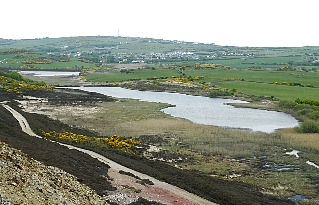
Ponds below Mynydd Parys
These ponds received the water flowing out from the precipitation ponds, probably laden with all sorts of toxic minerals. Perhaps the shallow reedy ponds helped to clean the effluent up before it was discharged. The village beyond is Penysarn, and on the skyline is the television transmitter on a unnamed hilltop.
 Map © Crown Copyright")
TIP: Click the map for more Large scale mapping
- Grid Square
- SH4490, 157 images (more nearby 🔍)
- Photographer
- Anne Burgess (more nearby)
- Date Taken
- Wednesday, 19 May, 2010 (more nearby)
- Submitted
- Tuesday, 29 June, 2010
- Subject Location
-
OSGB36:
 SH 448 901 [100m precision]
WGS84: 53:23.1252N 4:20.0833W - Camera Location
-
OSGB36: SH 444 901
- View Direction
- EAST (about 90 degrees)