2010
SP1622 : Old Mill, Lower Slaughter - Which one is it?
taken 14 years ago, near to Lower Slaughter, Gloucestershire, England
Old Mill, Lower Slaughter - Which one is it?
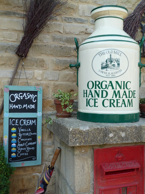
Organic or ogasmic? Possibly both I suppose. Sign outside the shop at the Old Mill, Lower Slaughter
 Map © Crown Copyright")
TIP: Click the map for more Large scale mapping
- Grid Square
- SP1622, 232 images (more nearby 🔍)
- Photographer
- Chris Allen (more nearby)
- Date Taken
- Sunday, 27 June, 2010 (more nearby)
- Submitted
- Tuesday, 29 June, 2010
- Subject Location
-
OSGB36:
 SP 163 226 [100m precision]
WGS84: 51:54.1023N 1:45.8175W - Camera Location
-
OSGB36: SP 163 225
- View Direction
- Northwest (about 315 degrees)