2010
SD9801 : Pennine Bridleway near Castle Farm
taken 14 years ago, near to Buckton Vale, Tameside, England
This is 1 of 8 images, with title starting with Pennine Bridleway in this square
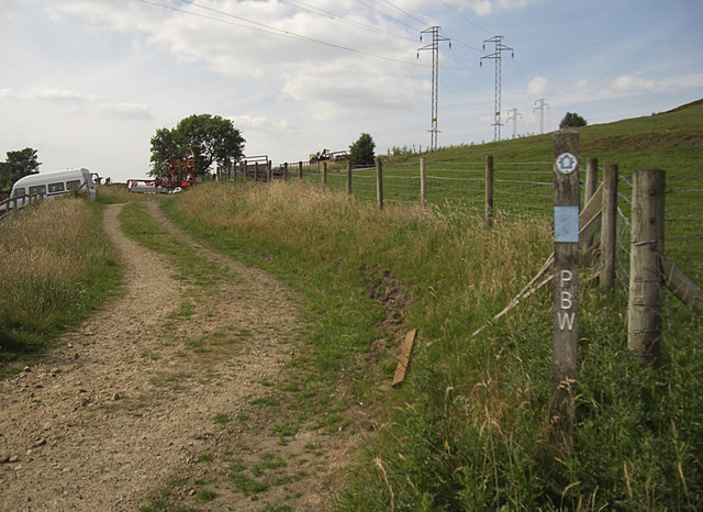
Pennine Bridleway near Castle Farm
Castle Farm is on Castle Lane just out of shot on the left. The track is Moor Edge Road that forms part of the National Trail between Carrbrook and Greenfield. Here we are looking towards Greenfield.
 Map © Crown Copyright")
TIP: Click the map for more Large scale mapping
- Grid Square
- SD9801, 61 images (more nearby 🔍)
- Photographer
- michael ely (more nearby)
- Date Taken
- Wednesday, 30 June, 2010 (more nearby)
- Submitted
- Wednesday, 30 June, 2010
- Subject Location
-
OSGB36:
 SD 986 014 [100m precision]
WGS84: 53:30.5948N 2:1.3005W - Camera Location
-
OSGB36: SD 986 014
- View Direction
- NORTH (about 0 degrees)