2010
NS4473 : Remains of a jetty
taken 14 years ago, near to Bowling, West Dunbartonshire, Scotland
This is 1 of 3 images, with title Remains of a jetty in this square
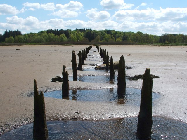
Remains of a jetty
The jetty is first shown, although apparently incomplete, on OS maps from 1914; it is depicted to its full length from 1918.
After reaching the grassy area at the top of the beach, its course can, on satellite imagery, be followed in the same direction for another 200 metres, in the form of a path across the grass; that area is indicated on the old maps as "saltings". The path will have continued further, but the creation of a golf course has obliterated its remains.
See NS4473 : Remains of a jetty for a view in the opposite direction along the same ruined jetty.
Faint traces of an even earlier jetty can be seen on this beach, about 200 metres to the east: NS4473 : Remains of a jetty.
 Map © Crown Copyright")
TIP: Click the map for more Large scale mapping
- Grid Square
- NS4473, 253 images (more nearby 🔍)
- Photographer
- Lairich Rig (more nearby)
- Date Taken
- Sunday, 20 June, 2010 (more nearby)
- Submitted
- Thursday, 1 July, 2010
- Subject Location
-
OSGB36:
 NS 4431 7325 [10m precision]
WGS84: 55:55.6225N 4:29.6053W - Camera Location
-
OSGB36: NS 4429 7333
- View Direction
- South-southeast (about 157 degrees)