2010
SP0931 : Where's the path
taken 14 years ago, near to Cutsdean, Gloucestershire, England
Where's the path
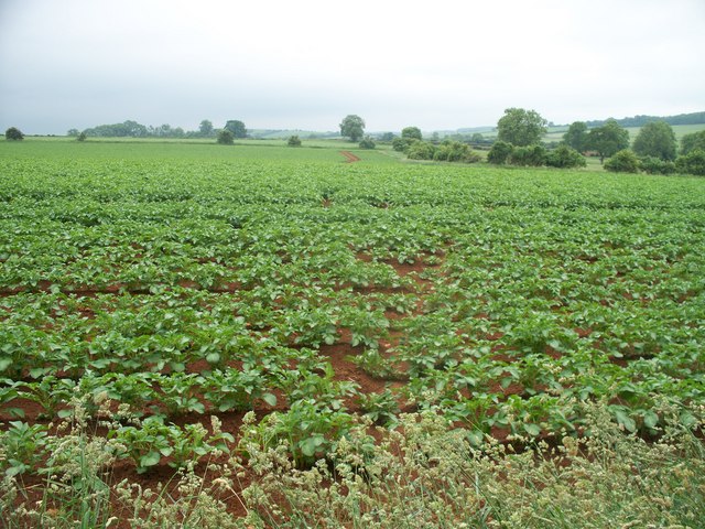
Seen from the point where the footpath leaves the restricted byway, the line of the footpath runs straight ahead. The path has not been reinstated through the crop of potatoes.
 Map © Crown Copyright")
TIP: Click the map for more Large scale mapping
- Grid Square
- SP0931, 14 images (more nearby 🔍)
- Photographer
- Michael Dibb (more nearby)
- Date Taken
- Monday, 14 June, 2010 (more nearby)
- Submitted
- Saturday, 3 July, 2010
- Subject Location
-
OSGB36:
 SP 0927 3122 [10m precision]
WGS84: 51:58.7621N 1:51.9866W - Camera Location
-
OSGB36: SP 0931 3130
- View Direction
- South-southwest (about 202 degrees)