2010
SZ0386 : Sandbanks Ferry and South Haven
taken 14 years ago, near to Sandbanks, Bournemouth, Christchurch & Poole, England
Sandbanks Ferry and South Haven
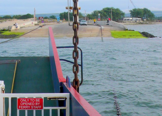
View from the ferry towards the landing slipway on the Studland side. the vertical chain supports and can raise or lower the vehicle access ramp on the ferry. One of the two propulsion chains can be seen in the water and on the slipway.
 Map © Crown Copyright")
TIP: Click the map for more Large scale mapping
- Grid Square
- SZ0386, 290 images (more nearby 🔍)
- Photographer
- Nigel Mykura (more nearby)
- Date Taken
- Thursday, 1 July, 2010 (more nearby)
- Submitted
- Sunday, 4 July, 2010
- Subject Location
-
OSGB36:
 SZ 036 867 [100m precision]
WGS84: 50:40.8077N 1:56.9991W - Camera Location
-
OSGB36: SZ 036 867
- View Direction
- Southwest (about 225 degrees)