2010
TR0616 : View of Dungeness Power Station
taken 14 years ago, 4 km SW of Lydd-on-Sea, Kent, England
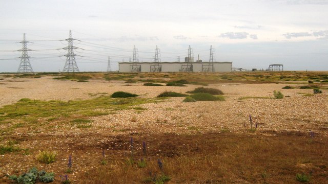
View of Dungeness Power Station
As seen from Dengemarsh lane, across the RSPB Dungeness Nature Reserve.
 Map © Crown Copyright")
TIP: Click the map for more Large scale mapping
- Grid Square
- TR0616, 33 images (more nearby 🔍)
- Photographer
- David Anstiss (more nearby)
- Date Taken
- Saturday, 3 July, 2010 (more nearby)
- Submitted
- Monday, 5 July, 2010
- Subject Location
-
OSGB36:
 TR 065 169 [100m precision]
WGS84: 50:54.8856N 0:56.2461E - Camera Location
-
OSGB36: TR 064 169
- View Direction
- EAST (about 90 degrees)