2010
TM4599 : St Olaves Priory
taken 14 years ago, near to St Olaves, Norfolk, England
This is 1 of 4 images, with title St Olaves Priory in this square
St Olaves Priory
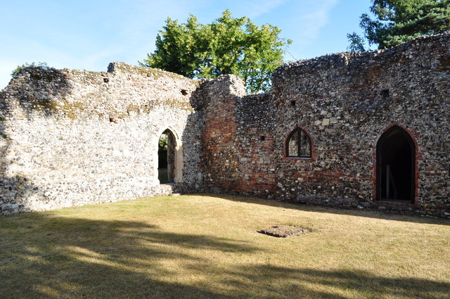
A view of the Priory with the undercroft door and windows visible.
The Augustinian priory in St Olaves was named after Olaf, King of Norway (d 1030). When it was suppressed in 1537 the buildings were sold to a local family who added a mansion and pulled down most of the church. What remained was taken into the guardianship of the state in 1921, mainly because of the still existing refectory undercroft which, built in around 1300 and considered to be an important early example of English brickwork. The vaulted ceiling is supported by five columns of Purbeck marble, the easternmost of which standing on a Roman millstone > Link. The priory ruins adjoin Priory Farm and restaurant > Link and are open to the public, as is the undercroft.
The Augustinian priory in St Olaves was named after Olaf, King of Norway (d 1030). When it was suppressed in 1537 the buildings were sold to a local family who added a mansion and pulled down most of the church. What remained was taken into the guardianship of the state in 1921, mainly because of the still existing refectory undercroft which, built in around 1300 and considered to be an important early example of English brickwork. The vaulted ceiling is supported by five columns of Purbeck marble, the easternmost of which standing on a Roman millstone > Link. The priory ruins adjoin Priory Farm and restaurant > Link and are open to the public, as is the undercroft.
 Map © Crown Copyright")
TIP: Click the map for more Large scale mapping
- Grid Square
- TM4599, 423 images (more nearby 🔍)
- Photographer
- Ashley Dace (more nearby)
- Date Taken
- Tuesday, 6 July, 2010 (more nearby)
- Submitted
- Tuesday, 6 July, 2010
- Subject Location
-
OSGB36:
 TM 458 995 [100m precision]
WGS84: 52:32.3016N 1:37.4260E - Camera Location
-
OSGB36: TM 458 995
- View Direction
- North-northwest (about 337 degrees)