2010
SK1383 : The Western Hope Valley Viewed from Treak Cliff
taken 14 years ago, near to Castleton, Derbyshire, England
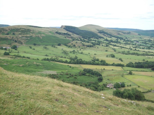
The Western Hope Valley Viewed from Treak Cliff
Several features can be picked out here. The building to the bottom-right is Knowlegates Farm and the darker area to the left of this is the disused Odin Mine. Hollin's Cross, Back Tor and Lose Hill are all visible on the horizon.
 Map © Crown Copyright")
TIP: Click the map for more Large scale mapping
- Grid Square
- SK1383, 184 images (more nearby 🔍)
- Photographer
- Jonathan Clitheroe (more nearby)
- Date Taken
- Sunday, 11 July, 2010 (more nearby)
- Submitted
- Monday, 12 July, 2010
- Subject Location
-
OSGB36:
 SK 137 834 [100m precision]
WGS84: 53:20.8498N 1:47.7313W - Camera Location
-
OSGB36: SK 134 830
- View Direction
- Northeast (about 45 degrees)