2010
TR2363 : Stodmarsh Information Board
taken 14 years ago, near to Upstreet, Kent, England
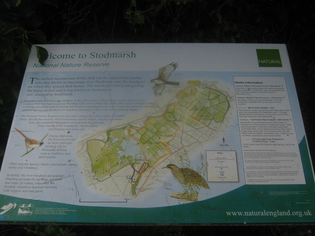
Stodmarsh Information Board
Map and information board on a footpath into the reserve from Grove Ferry Road.
Stodmarsh Nature Reserve
It is located in the lower regions of the north Kent plain within the Stour valley. The reserve developed when coal mining subsidence formed marshland with large reedbeds, lakes, ditches, meadows and wet woodland. There are many bird hides and an observation mound in the reserve accessed by a network of footpaths. One path follows the Great Stour river for much of its length within the reserve area.
See Linkfor more details about the reserve and a online map.
 Map © Crown Copyright")
TIP: Click the map for more Large scale mapping
- Grid Square
- TR2363, 104 images (more nearby 🔍)
- Photographer
- David Anstiss (more nearby)
- Date Taken
- Sunday, 11 July, 2010 (more nearby)
- Submitted
- Wednesday, 14 July, 2010
- Subject Location
-
OSGB36:
 TR 235 630 [100m precision]
WGS84: 51:19.3458N 1:12.4043E - Camera Location
-
OSGB36: TR 235 630
- View Direction
- Southeast (about 135 degrees)