2010
TG2208 : The tower of St Benedict's church, Norwich
taken 14 years ago, near to Norwich, Norfolk, England
This is 1 of 2 images, with title The tower of St Benedict's church, Norwich in this square
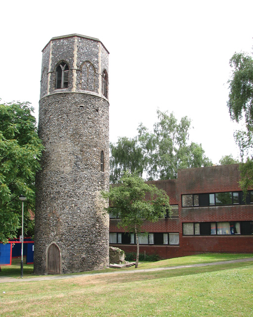
The tower of St Benedict's church, Norwich
The round tower is all that remains of the church which was destroyed by a bomb in 1942. The tower is surrounded by the Ten Bell Court housing development > Link.
 Map © Crown Copyright")
TIP: Click the map for more Large scale mapping
- Grid Square
- TG2208, 4039 images (more nearby 🔍)
- Photographer
- Evelyn Simak (more nearby)
- Date Taken
- Wednesday, 14 July, 2010 (more nearby)
- Submitted
- Wednesday, 14 July, 2010
- Subject Location
-
OSGB36:
 TG 224 088 [100m precision]
WGS84: 52:37.8798N 1:17.1599E - Camera Location
-
OSGB36: TG 224 088
- View Direction
- SOUTH (about 180 degrees)