2010
SD9123 : Sourhall Road, Clough Foot, Todmorden
taken 14 years ago, near to Clough Foot, Calderdale, England
This is 1 of 2 images, with title starting with Sourhall Road, Clough Foot in this square
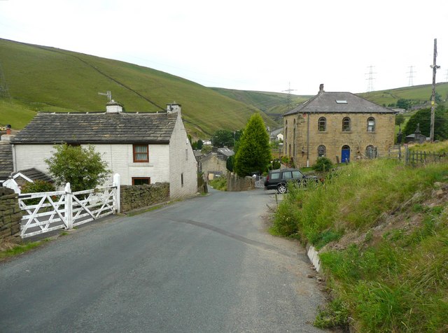
Sourhall Road, Clough Foot, Todmorden
This part of the road is called Back o'th' Edge on the 1848 map. The road name was changed on maps to Sourhall Road between 1894 and 1907. The buildings are at the edge of the hamlet, and the one on the right is a former Independent chapel, and is just in the next square (SD9023).
 Map © Crown Copyright")
TIP: Click the map for more Large scale mapping
- Grid Square
- SD9123, 59 images (more nearby 🔍)
- Photographer
- Humphrey Bolton (more nearby)
- Date Taken
- Tuesday, 13 July, 2010 (more nearby)
- Submitted
- Wednesday, 14 July, 2010
- Subject Location
-
OSGB36:
 SD 910 238 [100m precision]
WGS84: 53:42.6325N 2:8.2698W - Camera Location
-
OSGB36: SD 910 238
- View Direction
- West-southwest (about 247 degrees)