2006
TQ0476 : Longford River bridge with William IV 1834 sign
taken 18 years ago, near to Longford, Hillingdon, England
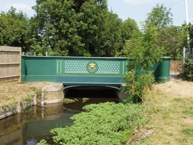
Longford River bridge with William IV 1834 sign
The bridge is at the west of the village of Longford, near the A3044 roundabout. The river was dug in 1638 when Charles I wanted to divert water from the Colne to Hampton Court gardens. The bridge was built in 1834; see "This is Longford" site Link (Archive Link ) for a detailed account. The river and bridge are still crown property.
 Map © Crown Copyright")
TIP: Click the map for more Large scale mapping
- Grid Square
- TQ0476, 133 images (more nearby 🔍)
- Photographer
- David Hawgood (more nearby)
- Date Taken
- Tuesday, 4 July, 2006 (more nearby)
- Submitted
- Wednesday, 5 July, 2006
- Subject Location
-
OSGB36:
 TQ 047 766 [100m precision]
WGS84: 51:28.7207N 0:29.6239W - View Direction
- NORTH (about 0 degrees)