2010
TM3691 : Ellingham Mill
taken 14 years ago, near to Ellingham, Norfolk, England
This is 1 of 6 images, with title Ellingham Mill in this square
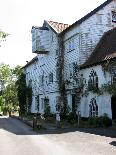
Ellingham Mill
Ellingham watermill was one of the only two Norfolk watermills on the Waveney.
Built on an artificial semicircular cut made to the north of the river the mill retained its head of water while the nearby lock on the main river controlled the levels for the Bungay Navigation. With the Waveney having been fully navigable for many years using a series of locks, one of which being next to Ellingham mill, grain and flour were transported to and from the mill via wherry as well as road. The mill ceased operating in 1967. Two years later its conversion for residential used was completed and the mill house and mill flats were advertised for sale.
Built on an artificial semicircular cut made to the north of the river the mill retained its head of water while the nearby lock on the main river controlled the levels for the Bungay Navigation. With the Waveney having been fully navigable for many years using a series of locks, one of which being next to Ellingham mill, grain and flour were transported to and from the mill via wherry as well as road. The mill ceased operating in 1967. Two years later its conversion for residential used was completed and the mill house and mill flats were advertised for sale.
 Map © Crown Copyright")
TIP: Click the map for more Large scale mapping
- Grid Square
- TM3691, 189 images (more nearby 🔍)
- Photographer
- Evelyn Simak (more nearby)
- Date Taken
- Sunday, 18 July, 2010 (more nearby)
- Submitted
- Monday, 19 July, 2010
- Subject Location
-
OSGB36:
 TM 365 917 [100m precision]
WGS84: 52:28.3285N 1:28.8451E - Camera Location
-
OSGB36: TM 365 917
- View Direction
- Southwest (about 225 degrees)