2010
SS8941 : Dunkery Beacon
taken 14 years ago, 3 km from Luckwell Bridge, Somerset, England
This is 1 of 12 images, with title Dunkery Beacon in this square
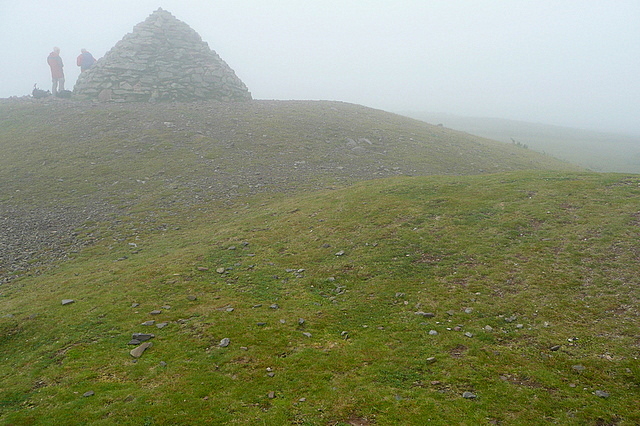
Dunkery Beacon
The highest point of Exmoor, at 519 metres. On a clear day one can apparently see 13 counties from here. We were lucky to see 13 metres. The beacon is part of the extensive Holnicote estate and the cairn commemorates the sale of the estate by the Acland family to the National Trust in 1944, allegedly for the benefit of a grateful nation but pragmatically to unburden the family from escalating estate costs.
 Map © Crown Copyright")
TIP: Click the map for more Large scale mapping
- Grid Square
- SS8941, 81 images (more nearby 🔍)
- Photographer
- Graham Horn (more nearby)
- Date Taken
- Tuesday, 20 July, 2010 (more nearby)
- Submitted
- Monday, 26 July, 2010
- Subject Location
-
OSGB36:
 SS 891 415 [100m precision]
WGS84: 51:9.7347N 3:35.1993W - Camera Location
-
OSGB36: SS 891 415
- View Direction
- East-northeast (about 67 degrees)