2010
TL3614 : Musley School
taken 14 years ago, near to Ware, Hertfordshire, England
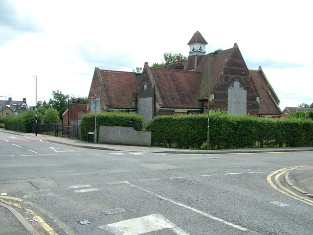
Musley School
The former Musley School seen from the junction of Homefield Road and Musley Hill. Hertfordshire County Council still own the building but seem undecided about what to do with it. Consequently it continues to deteriorate despite its Grade II listed status.
 Map © Crown Copyright")
TIP: Click the map for more Large scale mapping
- Grid Square
- TL3614, 72 images (more nearby 🔍)
- Photographer
- Rob Candlish (more nearby)
- Date Taken
- Wednesday, 11 August, 2010 (more nearby)
- Submitted
- Wednesday, 11 August, 2010
- Subject Location
-
OSGB36:
 TL 360 146 [100m precision]
WGS84: 51:48.8570N 0:1.6389W - Camera Location
-
OSGB36: TL 360 147
- View Direction
- South-southeast (about 157 degrees)