2000
SO8218 : The entrance to Gloucester Docks
taken 23 years ago, near to Gloucester, Gloucestershire, England
This is 1 of 2 images, with title The entrance to Gloucester Docks in this square
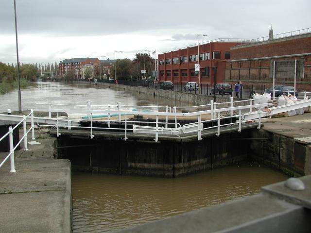
The entrance to Gloucester Docks
The River Severn is in flood and is in danger of getting higher than the water level in the lock into Gloucester Docks Link so defences have been erected! The Quay, normally visible on the right is submerged. On the other side of the road is Gloucester Gaol.
 Map © Crown Copyright")
TIP: Click the map for more Large scale mapping
- Grid Square
- SO8218, 1309 images (more nearby 🔍)
- Photographer
- David Stowell (more nearby)
- Date Taken
- Sunday, 5 November, 2000 (more nearby)
- Submitted
- Saturday, 9 April, 2005
- Subject Location
-
OSGB36:
 SO 825 185 [100m precision]
WGS84: 51:51.8881N 2:15.3328W - View Direction
- North-northeast (about 22 degrees)