2006
SH7152 : Northern slope of the Ceunant Ty'n y Ddol valley
taken 18 years ago, near to Dolwyddelan, Conwy, Wales
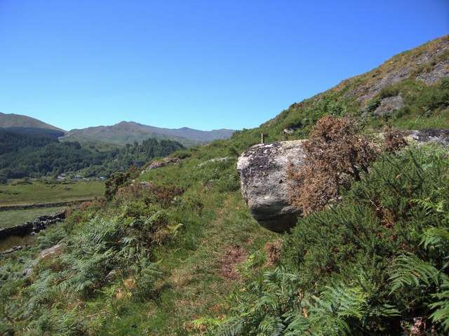
Northern slope of the Ceunant Ty'n y Ddol valley
This is part of the ridge on which Dolwyddelan castle was built. The peak in the background is Moel Dyrnogydd, and the Crimea pass, the most important road pass across the mountains of north Wales can be seen in the dip to its left (east).
Judging by the size of the streams feeding it, I would name the valley after Ceunant Ty'n y Ddol, but it's a close call; the other tributary, Afon Lledr, is of similar size.
Judging by the size of the streams feeding it, I would name the valley after Ceunant Ty'n y Ddol, but it's a close call; the other tributary, Afon Lledr, is of similar size.
 Map © Crown Copyright")
TIP: Click the map for more Large scale mapping
- Grid Square
- SH7152, 15 images (more nearby 🔍)
- Photographer
- Rudi Winter (more nearby)
- Date Taken
- Saturday, 15 July, 2006 (more nearby)
- Submitted
- Sunday, 16 July, 2006
- Subject Location
-
OSGB36:
 SH 717 520 [100m precision]
WGS84: 53:2.9891N 3:54.9284W - Camera Location
-
OSGB36: SH 717 520
- View Direction
- Southwest (about 225 degrees)