2006
TL2942 : Steeple Morden
taken 18 years ago, near to Steeple Morden, Cambridgeshire, England
Steeple Morden
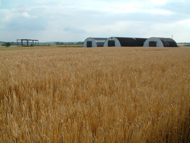
This view is from behind the RAF Memorial towards some of the old WWII buildings which formed part of Steeple Morden airfield. The whole area is now farmland.
 Map © Crown Copyright")
TIP: Click the map for more Large scale mapping
- Grid Square
- TL2942, 14 images (more nearby 🔍)
- Photographer
- Stuart Buchan (more nearby)
- Date Taken
- Thursday, 6 July, 2006 (more nearby)
- Submitted
- Tuesday, 18 July, 2006
- Subject Location
-
OSGB36:
 TL 298 423 [100m precision]
WGS84: 52:3.8326N 0:6.4772W - Camera Location
-
OSGB36: TL 299 424
- View Direction
- Southwest (about 225 degrees)