2010
SX2670 : St Cleer: across the Seaton valley
taken 14 years ago, near to Minions, Cornwall, England
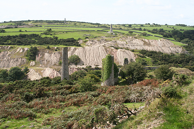
St Cleer: across the Seaton valley
Below Gonamena, with a view towards the waste dumps on West Caradon copper mine, closed in 1874. Two stacks and the iovy-covered remains of an engine house stand in the foreground, part of the successful South Caradon mine, worked from 1838 to 1884
 Map © Crown Copyright")
TIP: Click the map for more Large scale mapping
- Grid Square
- SX2670, 53 images (more nearby 🔍)
- Photographer
- Martin Bodman (more nearby)
- Date Taken
- Tuesday, 31 August, 2010 (more nearby)
- Submitted
- Wednesday, 1 September, 2010
- Subject Location
-
OSGB36:
 SX 265 701 [100m precision]
WGS84: 50:30.3079N 4:26.8168W - Camera Location
-
OSGB36: SX 265 701
- View Direction
- West-southwest (about 247 degrees)