2010
TL8564 : St Edmundsbury cathedral, Bury St Edmunds
taken 14 years ago, near to Bury st Edmunds, Suffolk, England
This is 1 of 8 images, with title St Edmundsbury cathedral, Bury St Edmunds in this square
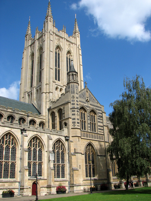
St Edmundsbury cathedral, Bury St Edmunds
Originally a parish church, the building > Link became a cathedral when the Diocese of St Edmundsbury and Ipswich was created in 1914. In 1020 the foundation of a Benedictine Abbey > Link was laid and Abbot Baldwin built the adjoining church of St Denys from 1065 - 1097. When he was replaced by Abbot Anselm the church was re-dedicated to St James. A new chancel was built in the 1400s and a nave added at the beginning of the 16th century. The medieval chancel was replaced in 1711 and a new chancel was built by Sir Gilbert Scott in 1860/70. A west porch and cloisters were added in 1950/61 and a Lady Chapel > Link and a crossing were constructed in 1963/70. Construction work on the north transept started in 1999, the Millennium Tower was completed in 2005 and the vaulted ceiling under the central tower > Link was completed in 2010. The cathedral has been much restored - with work still ongoing > Link - and no original features have survived. Font and font cover > Link date from the 19th century. Most of the stained glass > Link in the cathedral is Victorian. Only one window has much older (presumably) Continental glass > Link.
The abbey at Bury St Edmunds was established as a Benedictine foundation in 1020 by King Canute. It once housed the body of the martyred King Edmund, and for centuries pilgrims from throughout the world came to worship. At the dissolution of the monasteries by Henry VIII in the 16th century, the abbey was dismantled and fell into ruin. The cathedral in these days was St Marys church > Link situated across the churchyard, a short distance further to the south. St Mary's, the Abbeygate and the Norman Tower > Link are the only remains of the once vast complex of church buildings that stood alongside Angel Hill > Link.
The abbey at Bury St Edmunds was established as a Benedictine foundation in 1020 by King Canute. It once housed the body of the martyred King Edmund, and for centuries pilgrims from throughout the world came to worship. At the dissolution of the monasteries by Henry VIII in the 16th century, the abbey was dismantled and fell into ruin. The cathedral in these days was St Marys church > Link situated across the churchyard, a short distance further to the south. St Mary's, the Abbeygate and the Norman Tower > Link are the only remains of the once vast complex of church buildings that stood alongside Angel Hill > Link.
 Map © Crown Copyright")
TIP: Click the map for more Large scale mapping
- Grid Square
- TL8564, 1965 images (more nearby 🔍)
- Photographer
- Evelyn Simak (more nearby)
- Date Taken
- Tuesday, 31 August, 2010 (more nearby)
- Submitted
- Friday, 3 September, 2010
- Subject Location
-
OSGB36:
 TL 855 641 [100m precision]
WGS84: 52:14.6435N 0:43.0090E - Camera Location
-
OSGB36: TL 855 641
- View Direction
- Northeast (about 45 degrees)