2010
SE0921 : Boundary stones, Clay House, Greetland
taken 14 years ago, near to Greetland, Calderdale, England
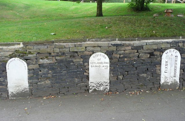
Boundary stones, Clay House, Greetland
Uprooted from their rightful position. The one between Scammonden and Barkisland was probably up above the central reservation of the M62. Soyland and Barkisland met in Ripponden, perhaps on the bridge. Fixby and Huddersfield goes back to the days when Fixby was a civil parish in Halifax Rural District.
 Map © Crown Copyright")
TIP: Click the map for more Large scale mapping
- Grid Square
- SE0921, 281 images (more nearby 🔍)
- Photographer
- Humphrey Bolton (more nearby)
- Date Taken
- Monday, 30 August, 2010 (more nearby)
- Submitted
- Friday, 3 September, 2010
- Subject Location
-
OSGB36:
 SE 0970 2140 [10m precision]
WGS84: 53:41.3378N 1:51.2756W - Camera Location
-
OSGB36: SE 0970 2140
- View Direction
- North-northwest (about 337 degrees)