2010
NS4884 : Old windpump
taken 14 years ago, near to Croftamie, Stirling, Scotland
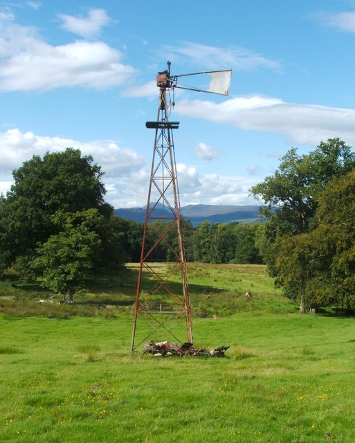
Old windpump
This structure stands almost 12 metres tall.
A plaque mounted about 3 metres above ground level on its south-western side identifies it as the product of "W. Dickie & Sons, Victoria Works, East Kilbride". This company, founded by William W. Dickie, produced a variety of farming equipment, but it was particularly known for the windpumps that it manufactured from the 1890s to the 1960s. The Dickie windpumps were once a familiar sight across the Scottish landscape.
For a closer look at some details, see NS4884 : Old windpump (detail from top) and NS4884 : Old windpump (detail from base). For a view of the field in which it stands, see NS4884 : Field at Aucheneck.
For a very similar example from Ayrshire, see NS5541 : Windpump at Laigh Hapton. See also NS6055 : Dickie Windpump.
Serving as a useful indicator of the direction of view, the peak that is visible directly behind the windpump is the top of Ben Lomond (NN3602).
Windpump at Aucheneck
A surviving example of the windpumps that were produced by William Dickie and Sons, of East Kilbride. It is included on the 1:25000 map.
 Map © Crown Copyright")
TIP: Click the map for more Large scale mapping
- Grid Square
- NS4884, 36 images (more nearby 🔍)
- Photographer
- Lairich Rig (more nearby)
- Date Taken
- Friday, 27 August, 2010 (more nearby)
- Submitted
- Saturday, 4 September, 2010
- Subject Location
-
OSGB36:
 NS 4802 8490 [10m precision]
WGS84: 56:1.9684N 4:26.4411W - Camera Location
-
OSGB36: NS 4805 8486
- View Direction
- Northwest (about 315 degrees)