2010
SP5106 : Benchmark at entrance to the Covered Market
taken 14 years ago, near to Oxford, Oxfordshire, England
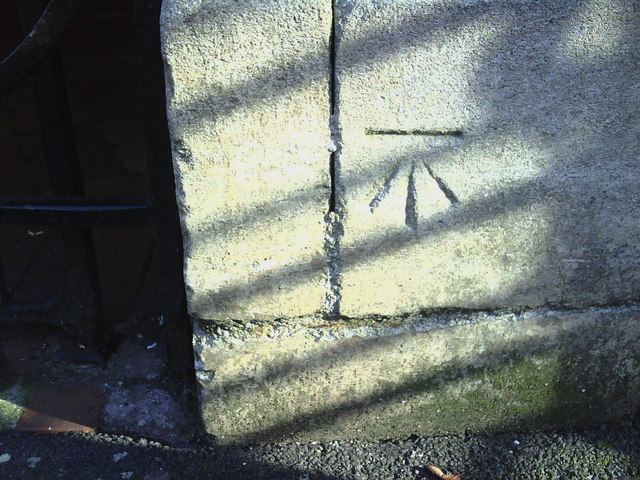
Benchmark at entrance to the Covered Market
Ordnance Survey cut mark benchmark described on the Bench Mark Database at Link .
.
 Map © Crown Copyright")
TIP: Click the map for more Large scale mapping
- Grid Square
- SP5106, 3721 images (more nearby 🔍)
- Photographer
- Roger Templeman (more nearby)
- Date Taken
- Wednesday, 1 September, 2010 (more nearby)
- Submitted
- Sunday, 5 September, 2010
- Subject Location
-
OSGB36:
 SP 5137 0628 [10m precision]
WGS84: 51:45.1719N 1:15.4336W - Camera Location
-
OSGB36: SP 5137 0628
- View Direction
- Southeast (about 135 degrees)