2010
NS4682 : Southern side of small enclosure
taken 14 years ago, 3 km from Craighat, Stirling, Scotland
Southern side of small enclosure
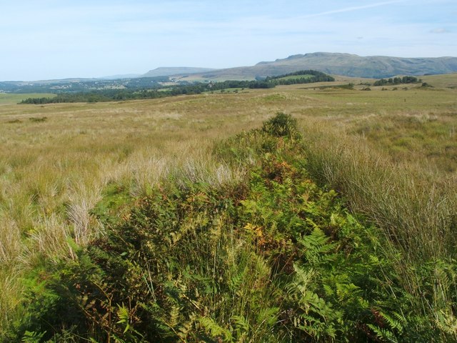
See NS4683 : Western side of old enclosure for the main description, which shows part of the boundary of a large enclosure. Attached to its southern side is a smaller enclosure, measuring about 150 metres (east-west) by 50 metres; the present photograph shows its southern boundary (see also an annotated satellite image, whose link is given in the end-note). The photograph was taken from a point just east of NS4682 : Mound beside old enclosure.
The line of the boundary can be seen here as a low ridge covered in bracken.
The green hill visible directly beyond its far end is Meikle Caldon (NS4983), with the Campsie Hills behind it; further away, left of centre, are the Fintry Hills, with the even more distant Ochil Hills, grey with haze, to their left.
Remains of an enclosure
This enclosure is part of a larger field system Link which pre-dates the first-edition OS map. It was probably associated with a farmhouse whose faint foundations Link can be seen nearby. See Link
for an annotated satellite image.
 Map © Crown Copyright")
TIP: Click the map for more Large scale mapping
- Grid Square
- NS4682, 37 images (more nearby 🔍)
- Photographer
- Lairich Rig (more nearby)
- Date Taken
- Tuesday, 31 August, 2010 (more nearby)
- Submitted
- Saturday, 11 September, 2010
- Subject Location
-
OSGB36:
 NS 4666 8280 [10m precision]
WGS84: 56:0.8113N 4:27.6773W - Camera Location
-
OSGB36: NS 4659 8279
- View Direction
- EAST (about 90 degrees)