2010
NX2258 : Dervaird Farm
taken 14 years ago, near to Carscreugh, Dumfries And Galloway, Scotland
This is 1 of 6 images, with title Dervaird Farm in this square
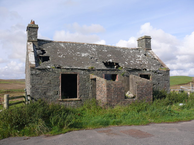
Dervaird Farm
View of this (still) ruined cottage at the entrance to the farm NX2258 : Ruined cottage at Dervaird. Originally it would have been at the side of the old A75 road.
 Map © Crown Copyright")
TIP: Click the map for more Large scale mapping
- Grid Square
- NX2258, 55 images (more nearby 🔍)
- Photographer
- Andy Farrington (more nearby)
- Date Taken
- Thursday, 30 September, 2010 (more nearby)
- Submitted
- Sunday, 3 October, 2010
- Subject Location
-
OSGB36:
 NX 224 583 [100m precision]
WGS84: 54:53.2908N 4:46.1727W - Camera Location
-
OSGB36: NX 224 583
- View Direction
- NORTH (about 0 degrees)