2010
TA0647 : Walking Tophill Low
taken 14 years ago, near to Aike, East Riding of Yorkshire, England
This is 1 of 7 images, with title Walking Tophill Low in this square
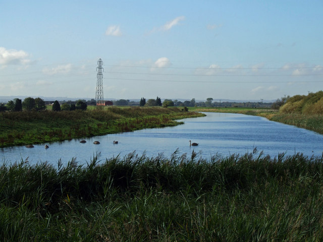
Walking Tophill Low
The River Hull.Wilfholme Pumping Station can be seen in the distance.
 Map © Crown Copyright")
TIP: Click the map for more Large scale mapping
- Grid Square
- TA0647, 59 images (more nearby 🔍)
- Photographer
- Keith Laverack (more nearby)
- Date Taken
- Thursday, 7 October, 2010 (more nearby)
- Submitted
- Friday, 8 October, 2010
- Subject Location
-
OSGB36:
 TA 063 472 [100m precision]
WGS84: 53:54.6461N 0:22.9495W - Camera Location
-
OSGB36: TA 066 475
- View Direction
- Southwest (about 225 degrees)