1971
TL2519 : Datchworth: Swangley's Lane
taken 53 years ago, near to Knebworth, Hertfordshire, England
Datchworth: Swangley's Lane
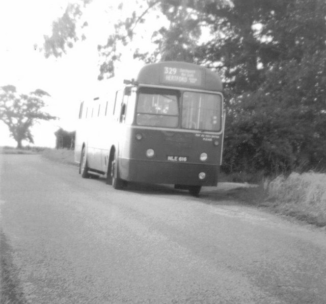
London Country RF616 (NLE616) with the last route 329 journey to serve Swangley's Lane, Datchworth. The bus is just passing the end of the track leading to Baines's Spring. One of the barns on Swangley's Farm can be seen in the background.
 Map © Crown Copyright")
TIP: Click the map for more Large scale mapping
- Grid Square
- TL2519, 25 images (more nearby 🔍)
- Photographer
- Rob Candlish (more nearby)
- Date Taken
- Friday, 6 August, 1971 (more nearby)
- Submitted
- Monday, 11 October, 2010
- Subject Location
-
OSGB36:
 TL 259 195 [100m precision]
WGS84: 51:51.6414N 0:10.3529W - Camera Location
-
OSGB36: TL 259 195
- View Direction
- WEST (about 270 degrees)