2010
TQ2076 : Thames Path under Chiswick Bridge
taken 14 years ago, near to Mortlake, Richmond Upon Thames, England
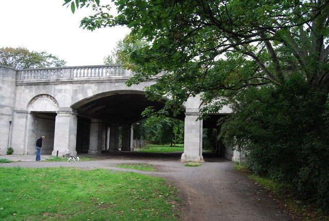
Thames Path under Chiswick Bridge
Thames Path
This National Trail is 184 miles (294 km) long, following the River Thames from its source in the Cotswolds almost to the sea, finishing at the Thames Barrier in Greenwich.
The trail keeps to the banks of the river most of the route.
Website: Link
Chiswick Bridge
Chiswick Bridge is a reinforced concrete deck arch bridge over the River Thames. Opened in 1933, it carries the A316 road between Chiswick and Mortlake.
The bridge is 606 feet long and faced with Portland stone. The bridge is possibly best known for its proximity to the end of the University Boat Race.
 Map © Crown Copyright")
TIP: Click the map for more Large scale mapping
- Grid Square
- TQ2076, 221 images (more nearby 🔍)
- Photographer
- N Chadwick (more nearby)
- Date Taken
- Wednesday, 25 August, 2010 (more nearby)
- Submitted
- Sunday, 17 October, 2010
- Subject Location
-
OSGB36:
 TQ 202 762 [100m precision]
WGS84: 51:28.3520N 0:16.1933W - Camera Location
-
OSGB36: TQ 202 762
- View Direction
- North-northwest (about 337 degrees)