2010
SK1396 : The source of the River Derwent
taken 13 years ago, near to Grinah Stones [other Features], Derbyshire, Great Britain
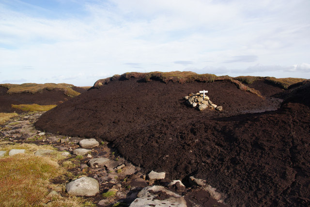
The source of the River Derwent
So the sign says, but there is no active watercourse in sight. Which way does it go?
harry hotplate adds: The sign went up in March 2002 and is (as with many rivers throughout the world) the ephemeral source of the River Derwent. It is on the highest point of the watershed and the run off from the cairn is to the left of the photograph (North) where it joins the lower tributary groughs on Swains Greave.
harry hotplate adds: The sign went up in March 2002 and is (as with many rivers throughout the world) the ephemeral source of the River Derwent. It is on the highest point of the watershed and the run off from the cairn is to the left of the photograph (North) where it joins the lower tributary groughs on Swains Greave.
 Map © Crown Copyright")
TIP: Click the map for more Large scale mapping
- Grid Square
- SK1396, 44 images (more nearby 🔍)
- Photographer
- Bill Boaden (more nearby)
- Date Taken
- Saturday, 30 October, 2010 (more nearby)
- Submitted
- Monday, 1 November, 2010
- Subject Location
-
OSGB36:
 SK 131 965 [100m precision]
WGS84: 53:27.9048N 1:48.1855W - Camera Location
-
OSGB36: SK 131 964
- View Direction
- Northeast (about 45 degrees)