2009
SU9191 : View from White House Lane
taken 15 years ago, near to Loudwater, Buckinghamshire, England
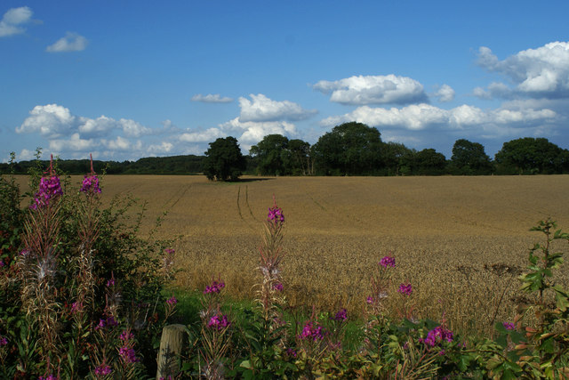
View from White House Lane
A view to the west from White House Lane across a field near Lude Farm. This area north of the A40 at Loudwater/Wooburn Moor and surrounding the railway line to Marylebone was known to many locals as the 'Roundabouts' long before the plethora of roundabouts on the A40 and other local roads appeared.
 Map © Crown Copyright")
TIP: Click the map for more Large scale mapping
- Grid Square
- SU9191, 11 images (more nearby 🔍)
- Photographer
- Rob Rogers (more nearby)
- Date Taken
- Friday, 7 August, 2009 (more nearby)
- Submitted
- Saturday, 6 November, 2010
- Subject Location
-
OSGB36:
 SU 913 913 [100m precision]
WGS84: 51:36.8201N 0:40.9337W - Camera Location
-
OSGB36: SU 913 913
- View Direction
- East-northeast (about 67 degrees)